THE PROJECT
Grwyne Fawr dam, located in the Grwyne Fawr Valley of the Brecon Beacons National Park, was constructed between 1912 and 1926, with the aim of providing a consistent water supply to the county of Monmouthshire and the growing steel and coal industries in the local area. MMB were commissioned by Dŵr Cymru Welsh Water to inform the design of remedial works required following a Reservoirs Act 1975 Section 10(2) Statutory Inspection of the Reservoir.
Geotechnical Engineering Ltd (GEL) were subsequently appointed as the specialist ground investigation contractor on the project, in order to gather representative information on the ground conditions and dam construction to inform geotechnical design.
THE CHALLENGE
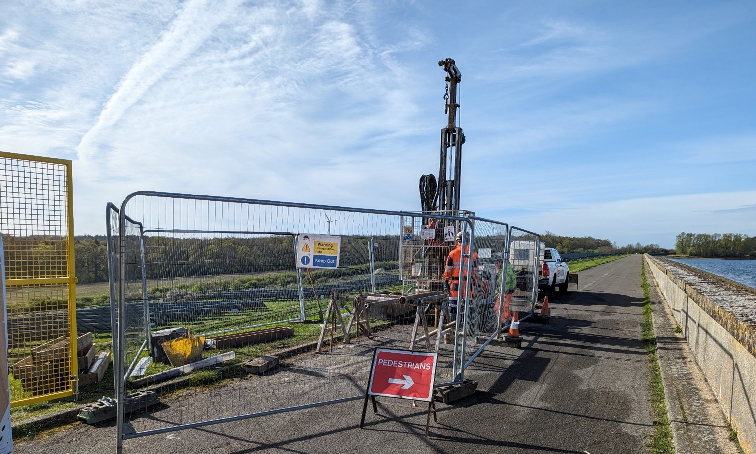
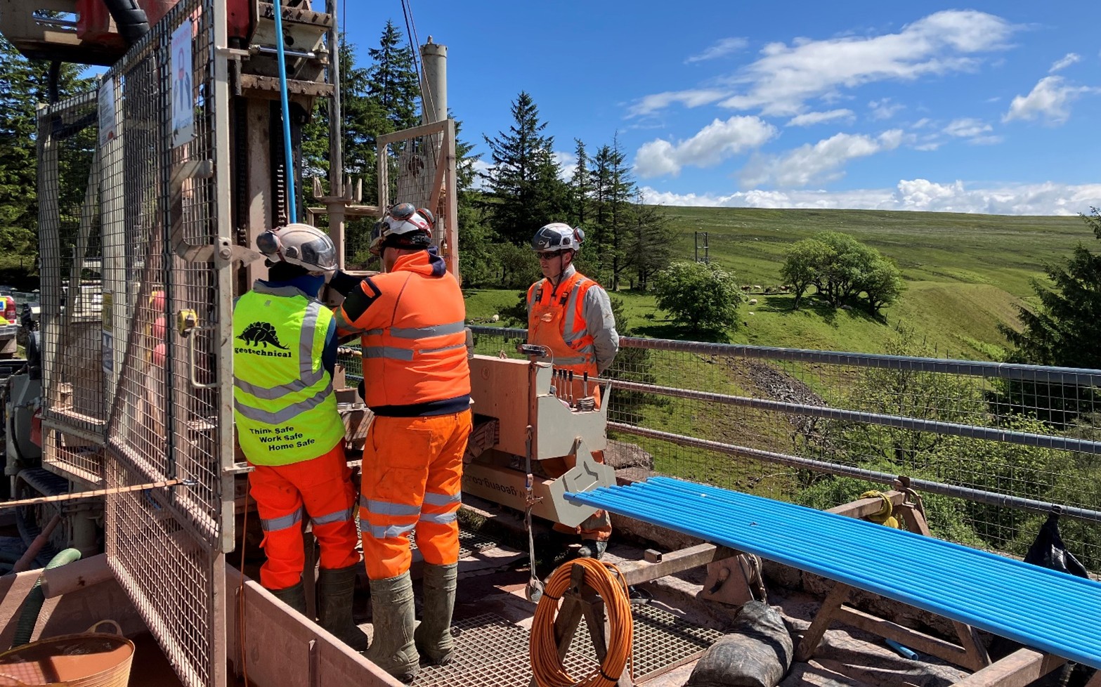
Given the site location at the head of the Grwyne Fawr Valley, perched at an elevation of 547mAOD, the biggest challenge was accessing the site and borehole positions. The 3km section of track from the base of the dam up to the crest is extremely narrow, with no passing places and was in a state of disrepair prior to the fieldwork. The site location made effective communication challenging, given the poor phone network signal.
The dam construction was understood to comprise cyclopean concrete, but the exact nature of the structure, including the extent of voids and the ratio of matrix to clasts, and clast size was unknown. This presented significant potential challenges when constructing boreholes, alongside a highly fractured bedrock stratum.
 THE SOLUTION
Several repairs to the access route were conducted prior to the works, to allow for the transportation of drilling plant, equipment and personnel to the exploratory locations. Inclement weather conditions meant the track conditions degraded over time, and additional remediation efforts were continually made to ensure accessibility through the works. As there were no passing places on the access route, all vehicular movements were required to be meticulously planned. The lack of phone network signal on site meant that portable two-way radio sets and a Starlink internet system were required to facilitate effective communication. 4×4 vehicles were exclusively used to mobilise equipment to the dam crest location.
Permissions and Licenses were obtained to allow the sourcing of water directly from the reservoir to use as drilling flush medium. This avoided the slow transportation of flush medium up the 3km track, maximising drilling productivity. Excess drilling flush was subsequently transported via 4×4 vehicles to the dam toe and stored in static containers, ready to be collected and disposed of by a licensed waste carrier on completion of the project.
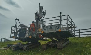
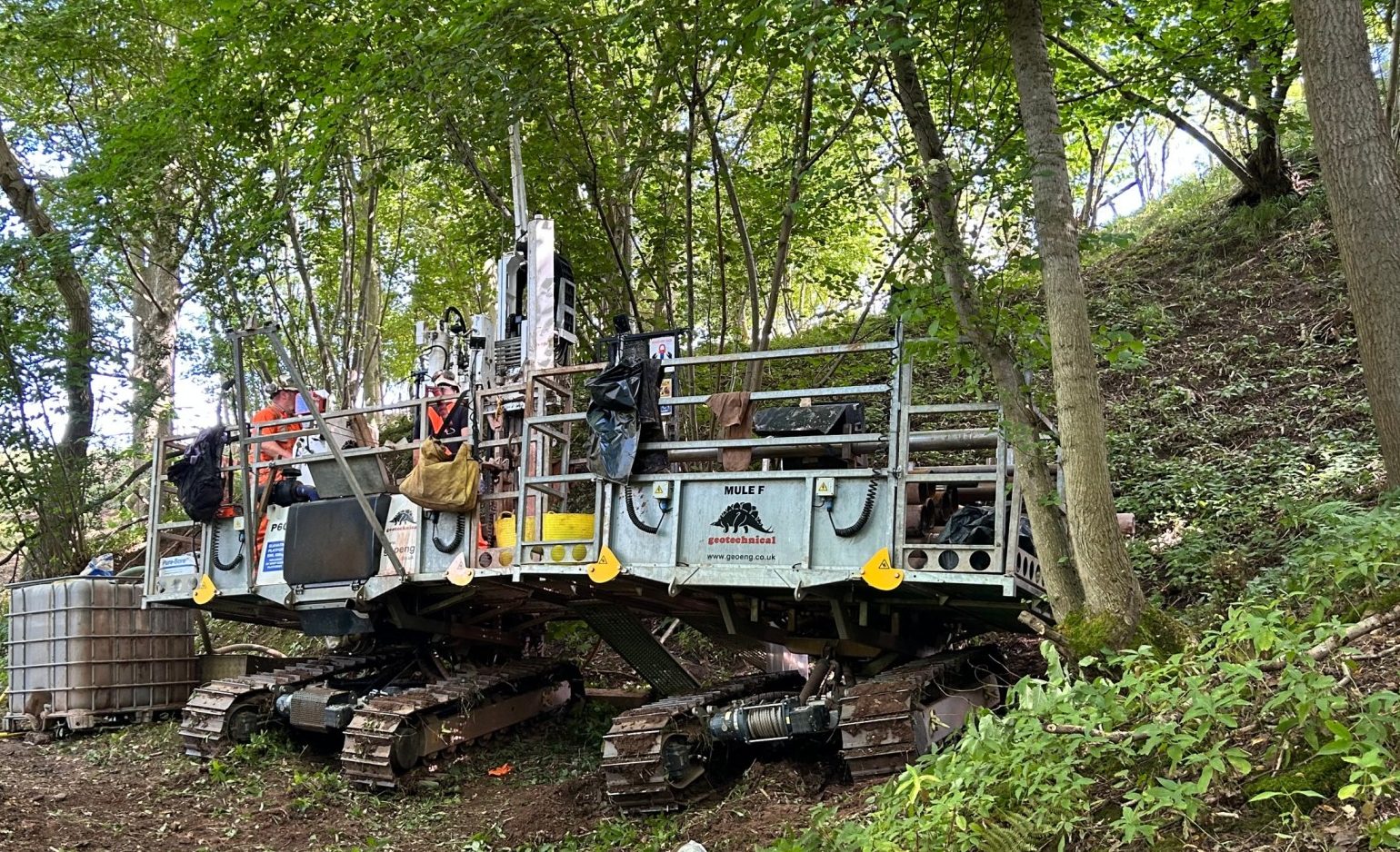
Following the resolution of complex access constraints, Geobor S wireline rotary core drilling techniques were employed at all borehole locations to maintain borehole stability and verticality, while optimising core recovery in the anticipated variable ground conditions. As the concrete clast components and the underlying bedrock was highly abrasive, it was essential for the drilling specialists to select equipment tailored to withstand these challenging conditions, ensuring tool durability and maximising core recovery. In certain areas, ground conditions proved more variable due to the presence of weathered mudstone interbedded with sandstone layers. To better characterise the subsurface conditions, downhole wireline optical imaging and acoustic televiewer surveys were conducted, providing detailed insights into the nature and orientation of fractures within the sandstone strata. Additionally, in situ Schmidt Hammer testing was performed on selected rock outcrops to provide comparative data against laboratory-derived strength parameters.
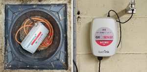
 Upon completion of the borehole construction, 8 vibrating wire piezometers (VWPs) were successfully installed. Prior planning ensured that the borehole diameters were adequate to accommodate dual VWPs within the deeper sandstone strata. The VWP cabling was routed through the dam crest using protective ducting and conduits, securely fixed to the concrete wave wall plinth. Due to limited 4G signal coverage, a remote telemetry system was deemed unfeasible, therefore multi-channel dataloggers were installed within an equipment cabinet located in the draw-off tower and connected to the VWP conduit cabling. The dataloggers were configured to record pore water pressure readings from all eight VWPs at hourly intervals. This setup enables Mott MacDonald Bentley (and Dŵr Cymru Welsh Water following handover) to monitor and assess variations in pore water pressure in response to changing weather conditions and reservoir water levels.
Through effective planning, comprehensive site walkovers, and close collaboration with our technical drilling advisors, GEL successfully acquired high-quality geotechnical samples and data. The subsequent complex stability study conducted by Mott MacDonald Bentley led to a “no build” solution, through providing improved confidence in the dam performance. Not only did this ensure the relevant reservoir safety certificate for the investigation and study was signed off on time, but provided significant cost and carbon savings to Dŵr Cymru Welsh Water.
 THE PROJECT
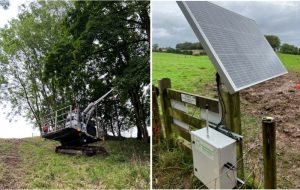 Installation of the ShapeArray™ monitoring instrumentation was undertaken with support from the supplier. A remote solar power supply and data transmitting point was installed at the top of the slope to send live information on the slope condition.