
 THE PROJECT
Kex Gill has a history of landslips and instability, historically resulting in many unplanned and costly closures of the A59, causing an inconvenience not just for road users, but for those in the surrounding towns and villages through which traffic is required to make a six-mile diversion. The A59 provides a very important east-west connection in North Yorkshire, linking Harrogate and Skipton. It extends across the north of England, between junction 31 of the M6 and junction 47 of the A1(M).
To address the effects of the instability at Kex Gill, it is proposed to re-route the section of highway west of Blubberhouses, involving the construction of a 3.9km section of new carriageway that bypasses the area of active landslides that impact the existing route.
WSP were commissioned by North Yorkshire Council to design and specify a ground investigation to further investigate the ground risk and groundwater conditions across the site, notably investigating the potential for abandoned lead mine workings, disused quarries, extensive alluvial deposits around the Hall Beck, and the potential excavatability and stability of future earthworks associated with the scheme.
Geotechnical Engineering Limited was engaged by John Sisk & Sons to complete an extensive investigation campaign.
THE CHALLENGE
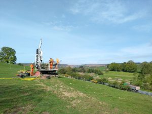
The site spanned a valley on the Yorkshire moors with limited access for wheeled vehicles. This challenge was amplified by thick forests, low vegetation, river/drainage runs and natural springs creating boggy ground which lined the valley floor. The Principal Contractor was undertaking pre-construction works concurrently with our ground investigation which gave rise to the need to plan works in a way that avoided conflict. The remote nature of the site left our equipment at risk of vandalism or theft over several bank holiday weekends.
THE SOLUTION
Prior to the mobilisation of the full project resource, several on site prestart meetings and site reconnaissance surveys were completed in conjunction with the Principal Contractor to discuss and integrate the ground investigation and civils programmes. Solutions to the logistical challenges were developed including ground levelling and compaction works, installation of temporary haul roads and creation of access routes and staging points for access directly from the A59 for large machinery. Significant vegetation clearance works of dense woodland was also required, to clear a route for a temporary trackway to be installed. This process was complicated by the proximity of the works to the Hall beck watercourse. To ensure that silt run off from our drilling activity and preparatory works did not impact the watercourse, silt bunds were constructed to protect the Hall Beck from our activity.
Given the volume of pre-construction works being conducted concurrently with our ground investigation activities, effective communication was imperative. Daily co-ordination meetings were held, with fortnightly programme updates provided to provide a mechanism to manage and mitigate changes in the sequences of both the ground investigation and civils activities.
Given the location of the site, it was identified during the planning stage of the works that securing the high value equipment between productive shifts would require additional measures. Armoured remote CCTV equipment was utilised at exploratory locations to provide 360° intruder detection measures, linked to a 24/7 rapid response unit, capable of attending site where required. Using this system not only secured our equipment during the works, but provided reassurance to landowners that mitigation of trespassing during the works was of critical importance.
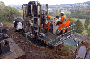
After overcoming the access challenges of the site, fourteen exploratory boreholes were completed utilising a Comacchio GEO 305 (Pioneer) or specialist slope climbing multi-purpose drilling rigs, to construction exploratory positions located on the valley sides. Prior to reaching the bedrock strata of the Millstone Grit Group (Mudstone, Siltstone, Sandstone), Marchup Grit (Sandstone) and Lower Follifoot Grit (Sandstone), Glacial Till, anthropogenic ground associated with the historical quarrying/ mining activity, and alluvium in proximity to the Hall Beck water course.
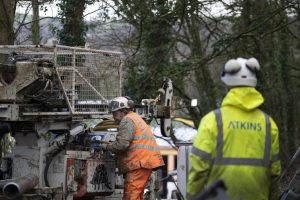
 A range of drilling techniques including dynamic sampling and rotary coring with biodegradable polymer flush media were utilised to construction the exploratory positions. The boreholes were advanced to the target depths of between 8.20 and 15.80m bgl as specified by the Consultant Engineer. Continuous gas monitoring, as well as the use of biodegradable polymer/ water flush were required to comply with The Mining Remediation Authority ‘Permit to Enter or Disturb MRA Interests’. Spark arrestors and Chalwyn valves are also integrated into drilling equipment in line with Geotechnical Engineering’s procedures for sites where there is a risk of flammable gases.
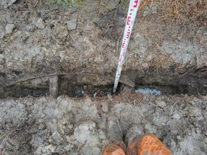
Machine dug excavations were conducted to obtain site wider shallow geotechnical samples and information on shallow ground conditions, with CBR testing required at selected locations. Hand-excavated trial pits were undertaken on site to a maximum depth of 1.50m bgl for the purposes of identifying historic mine workings and adit features. Measurements were taken of all features encountered and sketches were produced to give a schematic indication to the structures geometry.

 THE PROJECT
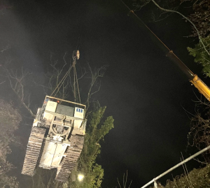 THE SOLUTION
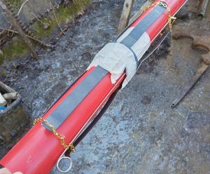 As future monitoring of the slope and remedial measures were the key focus of the investigation, a range of monitoring equipment was installed into each exploratory hole. Dual inclinometer and “spider” magnet extensometers were installed in four boreholes, set in a cement/bentonite grout mix, thus providing the opportunity for ongoing three-dimensional monitoring of slope movements. Two exploratory holes were also fitted with dual vibrating wire piezometers, using a fully grouted method along with the installation of secure electronic data loggers. By installing multiple pieces of monitoring apparatus within each exploratory hole, we were able to maximise the value of the investigation to the Client. Similarly, the retrofitting of four micro vibrating wire piezometers into two of the 19mm diameter boreholes installations from the original 1976 investigation maximised the value of the existing geotechnical assets. These additional installations were connected to secure multi-channel data loggers to allow for continuous data collection by the Consultant Engineer.
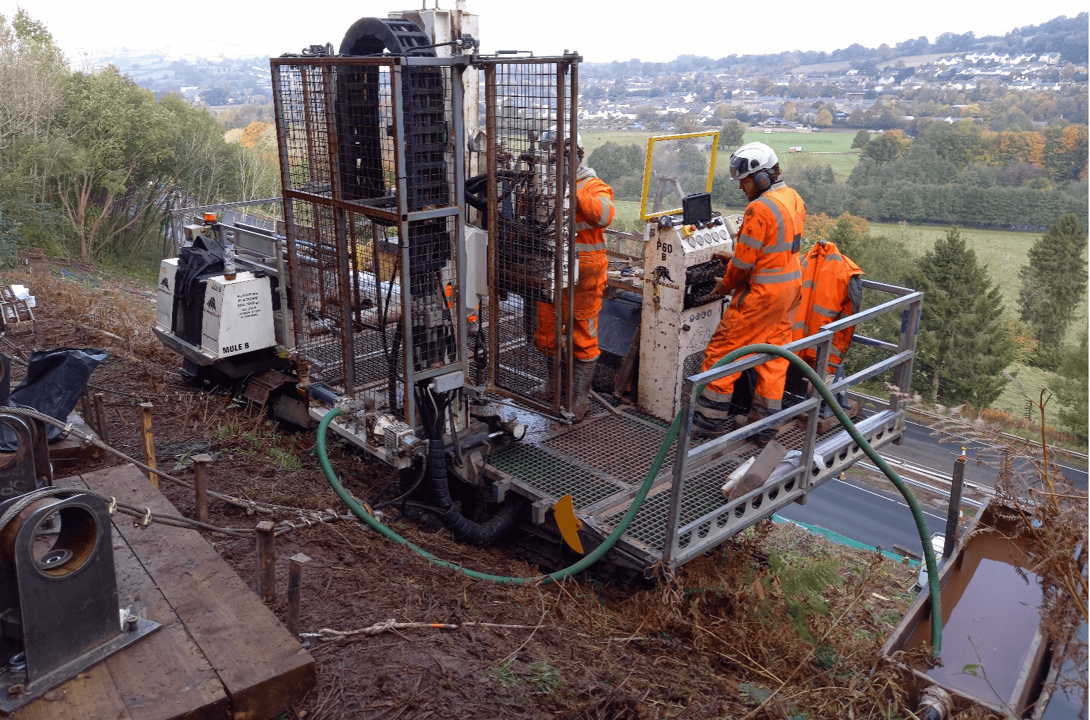
 THE PROJECT
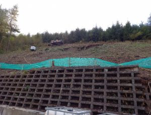 THE CHALLENGE
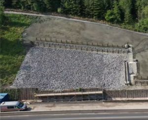 As an additional safety mechanism, safety tethering system was installed at the slope crest and proof loaded to a sufficient factor of safety to provide a failsafe mechanism during the fieldworks should further ground failures or loss of traction be suffered during the fieldworks.