A40 Brecon Bypass Landslide
A logistically complex ground investigation in a landslide setting
Client: Alun Griffiths/ North and Mid Wales Trunk Road Agent Engineer: Mott MacDonald Timeframe: 4 weeks Location: Brecon, Powys
 THE PROJECT
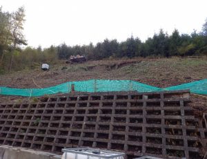
Following a period of significant rainfall associated with storm Ciara and storm Dennis, a 23m highway cutting suffered a significant failure, releasing 300m3 of hill wash material across the A40 Brecon Bypass trunk road in the area below the Nant-y-Ceiliog woodland. This event caused a full closure of the highway to remove the debris flow, with a continued closure of lane 1 for an extended period for safety purposes.
Mott MacDonald was engaged by North and Mid Wales Trunk Road Agent and the Welsh Government, to fulfill the role as designer on the project to implement the Design Manual for Roads and Bridges CD 622 – Managing geotechnical risk process. Alun Griffiths were appointed the main contractor for the early enabling works and subsequent remedial construction to restore the bypass to full capacity and prevent similar events occurring in the future.
Geotechnical Engineering were appointed as the specialist ground investigation contractor on the project, to collect geotechnical data required for the subsequent development of the remediation strategy and design optioneering of permanent design solutions.
 THE CHALLENGE
Access to the specified exploratory positions would prove the most challenging aspect of the ground investigation phase of the project. The complexities of slope climbing drilling works were further complicated by several site-specific factors. Dense vegetation consisting predominantly of mature Scots pine woodland, combined with the limited level area at the cutting with no agreed access through third party land were key challenges. The only possible access without significant regrading of the slope crest and additional clearance of mature woodland, would be via the cutting toe and the A40 itself. A concrete crib wall at the slope toe proved a challenging hurdle to overcome when accessing the slope.
It was identified that a crane would be required to lift the drilling rig and ancillary working platform onto the slope. To minimise the disruption to road users, these lifts were completed within a full road closure of the westbound carriageway.
THE SOLUTION
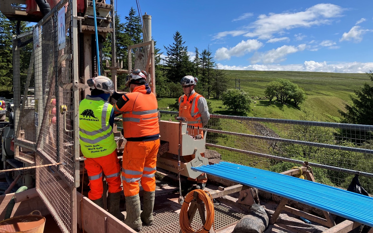
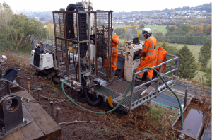
Nine dynamic sampling and rotary coring follow on boreholes were completed across the 30–34° slope, above, adjacent to and below the failure, by our in house designed P60 multipurpose slope climbing drilling rig and ancillary working platform.
This approach created a safe working platform at the otherwise inaccessible exploratory hole locations, protecting our site staff from risks associated with working at height. The rig and support platform were manoeuvred to and between each location using radio remote controls operated by the Lead Driller from an up-slope position of safety, meaning that the full road closures could be reduced to just a single lane during the fieldwork period.
 As an additional safety mechanism, safety tethering system was installed at the slope crest and proof loaded to a sufficient factor of safety to provide a failsafe mechanism during the fieldworks should further ground failures or loss of traction be suffered during the fieldworks.
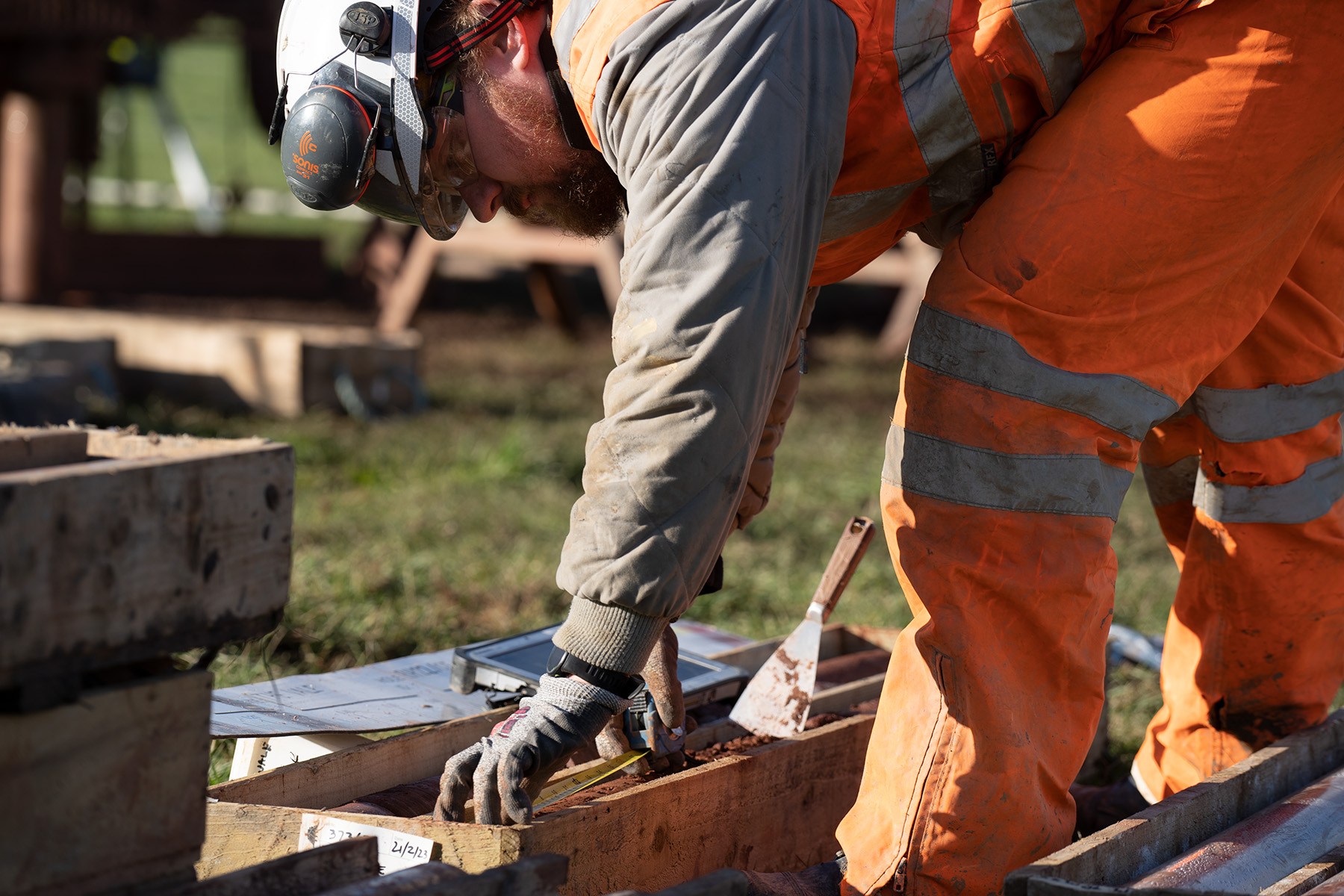
Full sample recovery of the poorly sorted granular glacial superficial deposits and St Maughans formation bedrock were recovered during the investigations, as well as specified in situ testing.
Based on the data provided during the ground investigation, it was determined that several factors triggered the debris flow. The heavy rainfall prior to the landslide event, combined with the previously unidentified, uncontrolled spring located at the cutting crest, were determined to have saturated the superficial deposits, causing the failure plane located at the shallow soil/rock contact.
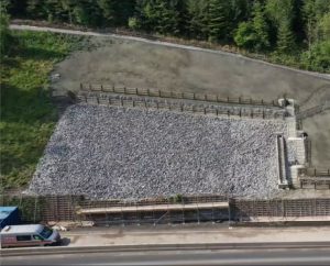
The detailed geological profile of the slope, created from the data collected during the ground investigation was subsequently utilised to determine the most appropriate, economically viable and safe permanent design solution to remediate the failure and mitigate future risk.