Grafham Reservoir
Ground Investigation for Remote Telemetry Installations
Client: Anglian Water Services Timeframe: 4 weeks Location: Grafham Water, Cambridgeshire
THE PROJECT
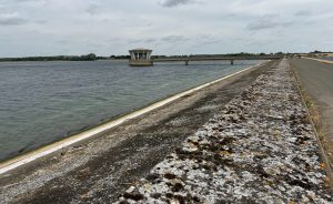
Grafham Water Dam is a 22m high zoned earth fill dam approximately 1.7 km in length. It is located close to the village of Perry, Cambridgeshire adjacent to the Grafham Water Treatment Works. The dam was built between 1962 and 1964, to designs prepared by Binnie & Partners.
During the construction phase, a range of instrumentation was incorporated into the embankment, to permit monitoring of water pressure levels and seepage flows. Following reporting of all data acquired from these geotechnical instruments, it was later recommended that new vibrating wire piezometers (VWP) be installed to replace the existing, ageing hydraulic instruments.
Geotechnical Engineering Limited (GEL) were appointed by Anglian Water Services as Principal Contractor, to deliver the scope of intrusive drilling works on the dam embankment. The data collected from the obtained samples would be utilised to understand the earthworks construction, with the boreholes being installed with specialist equipment for future remote monitoring.
THE CHALLENGE
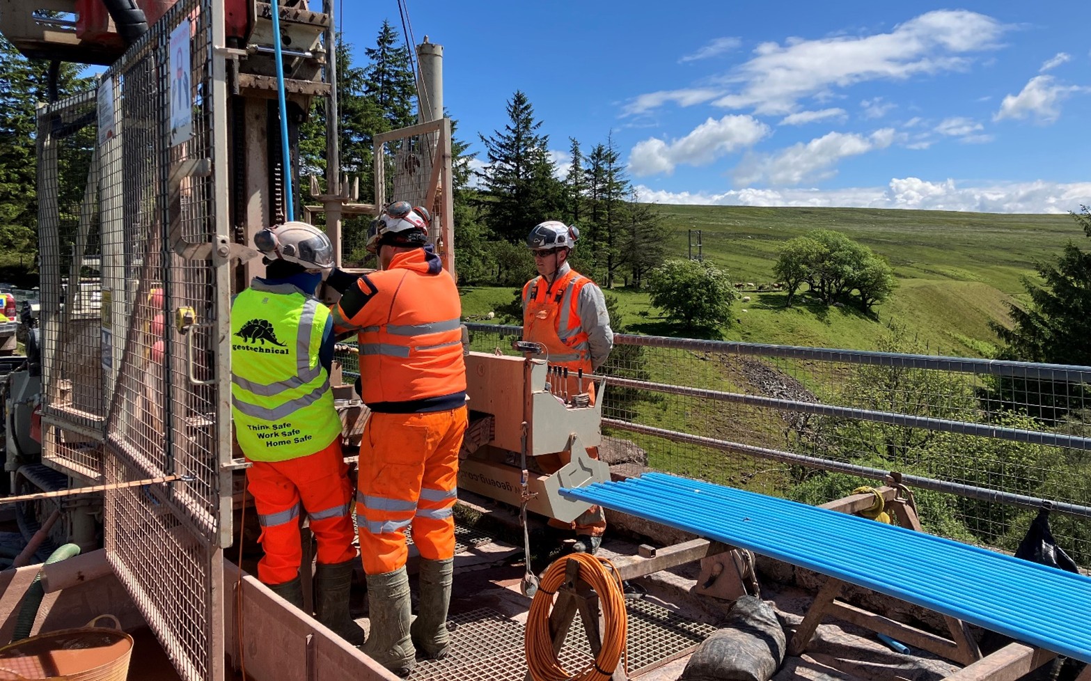
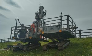
To achieve an effective monitoring network, a series of boreholes were specified to be constructed across the dam embankment crest, downstream shoulder and embankment toe. The mid-slope positions were located on areas of the embankment with slope angles up to 30°, in locations where traditional geotechnical drilling equipment would be unable to access without significant slope reprofiling.
The proximity of the exploratory positions to a public pedestrian walkway located at the crest of the embankment was a key project Health and Safety risk. The segregation of the public/works interface and continual management would be paramount to the safe delivery of the project.
It was also identified that surface settlement monitoring points that were installed at the time of the construction of the reservoir would need to be considered when moving equipment around site, to avoid disturbance to the apparatus. All site staff were briefed of their location during the site induction process, to ensure their operation remained unaffected during the fieldwork.
THE SOLUTION
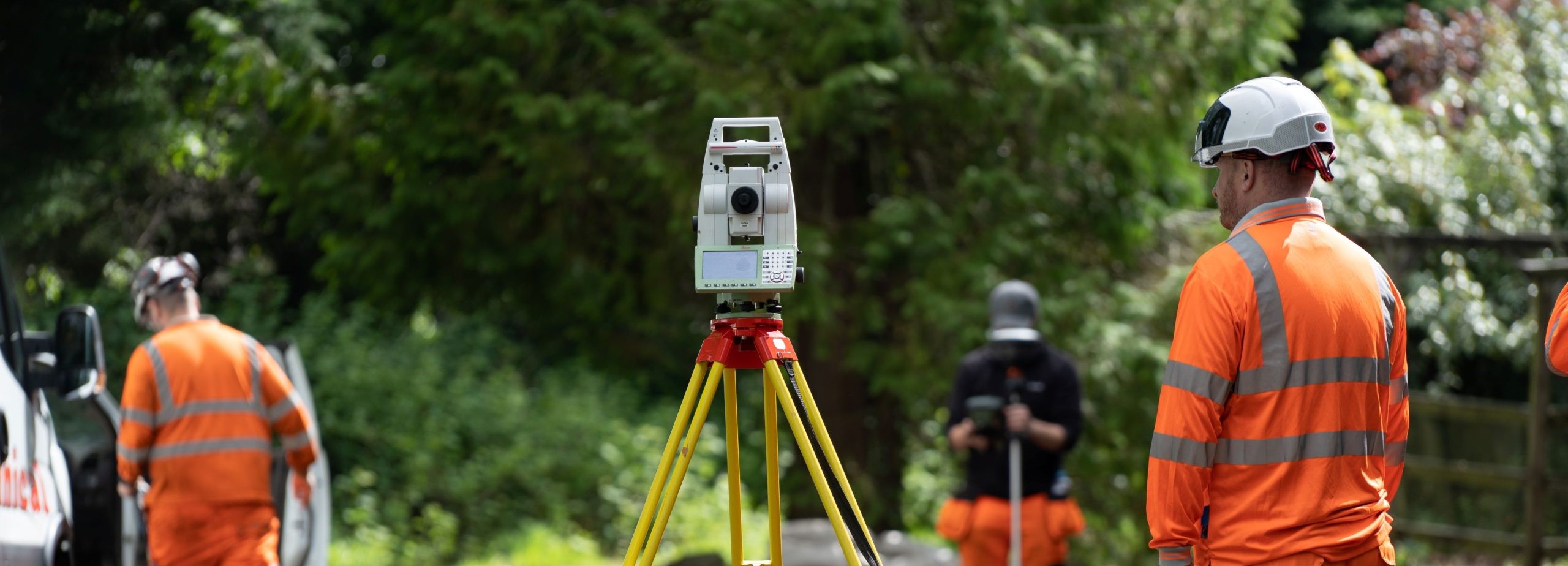
It was imperative that a detailed site walkover was undertaken by one of our highly experienced and qualified Drilling Supervisors, to understand the site-specific H & S risks, slope geometry of the downstream shoulder and other access restrictions. This knowledge was utilised by our health and safety and project management teams to develop a site-specific safe system of work.
The positions on the downstream shoulder were completed by one of our awards winning P60 multipurpose slope climbing rigs and ancillary working platform. This approach created a safe working area at the otherwise inaccessible exploratory hole locations, protecting our site staff from risks associated with working on slopes. The rig and support platform were manoeuvred to and between each location using radio remote controls operated by the Lead Driller from an up-slope position of safety.
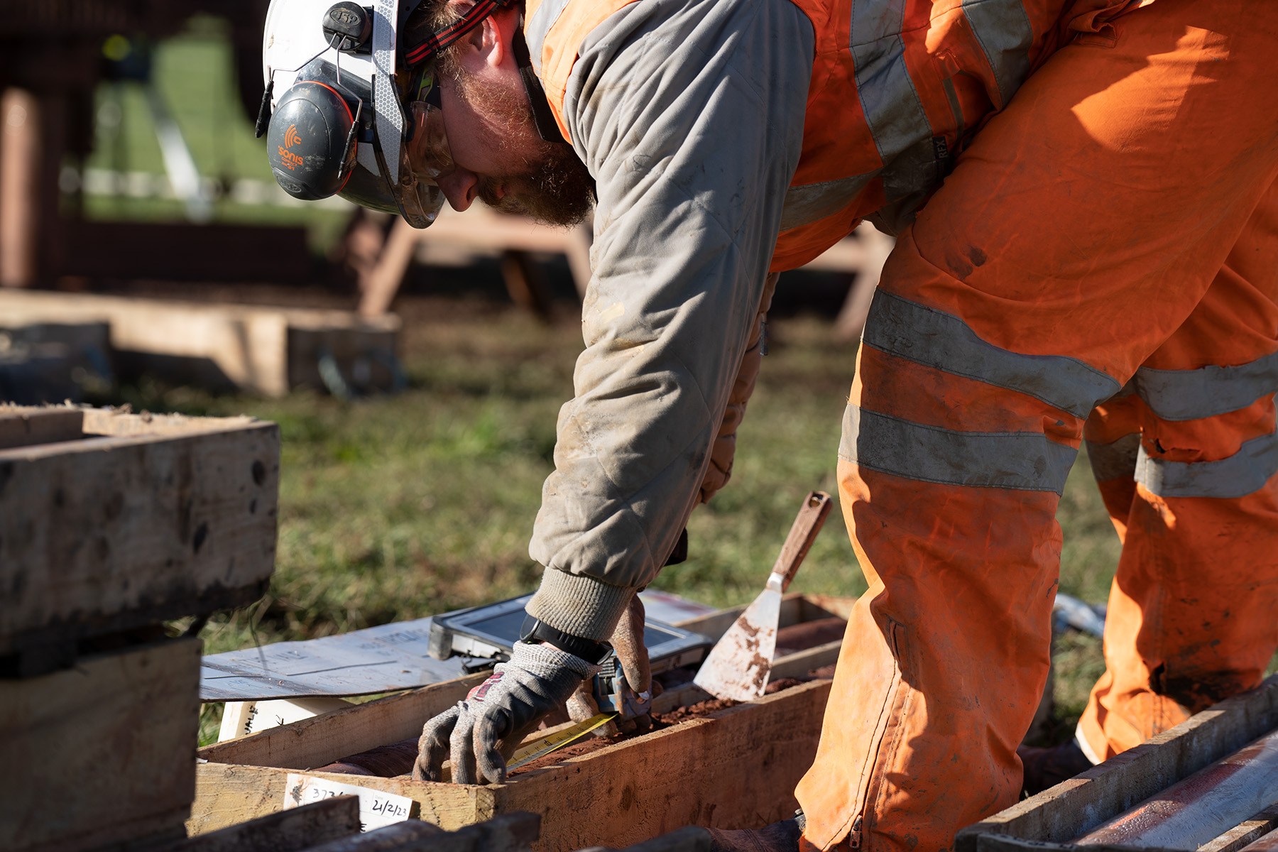
Detailed soil logging was required of the clay core, embankment fill and Oxford Clay formation, to determine the variability of the dam construction, and to understand the weathering profile beneath the structure of the dam. This was essential to determine the accuracy of the depths of each VWP installation.
VWP’s were installed in the boreholes at varying levels within the embankment structure and within the underlying Oxford Clay formation with the function of measuring the pore water pressures from the core of the dam, below the dam and within the embankment of the downstream face. Down-hole instrumentation was then backfilled using a grout medium to mitigate the creation of any open pathways within the embankment and maintain the embankments structural integrity.
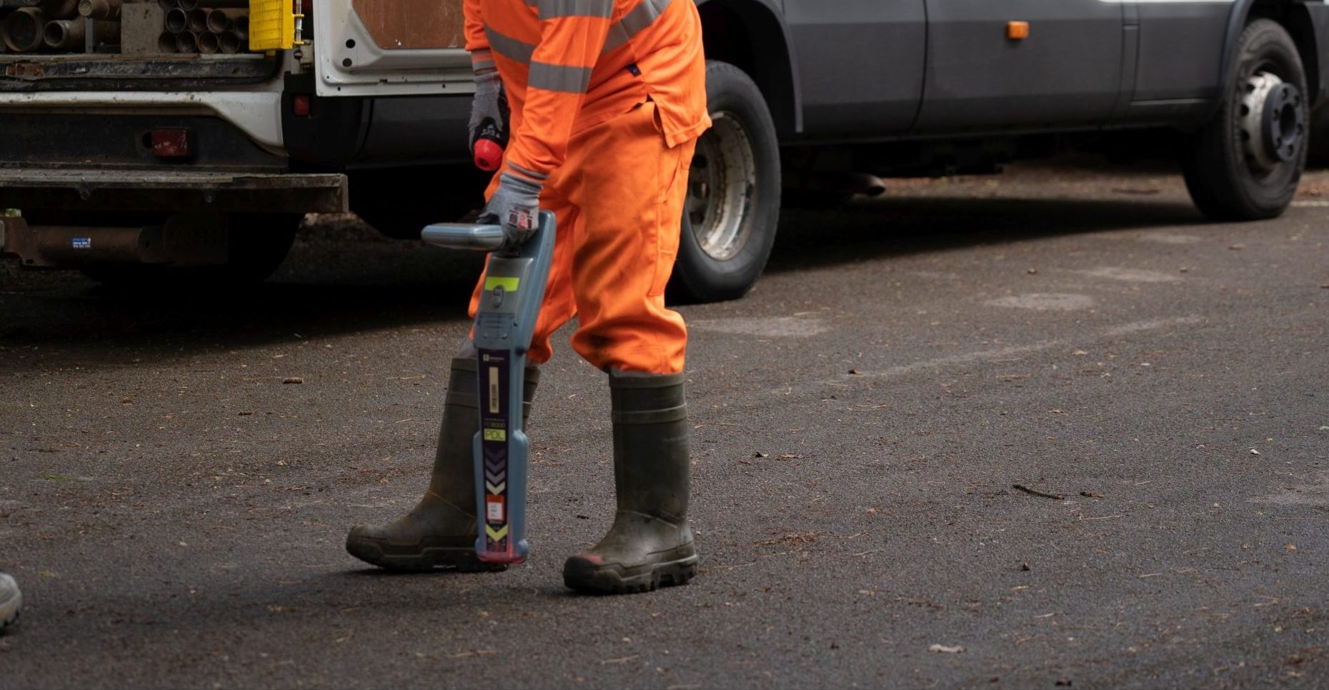
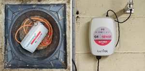
It was identified that a telemetry system that connected the VWP installations to an online, remotely accessible web portal, would have significant benefit to the Reservoirs Safety team. Several discussions were held between AW and GEL to establish the most suitable system of telemetry equipment, given the lack of network coverage in the area, and to agree the security measures to protect the apparatus.
To limit the impact on the site and keep our works discrete, the monitoring nodes were installed in plastic flush covers. The plastic material was used in this instance to ensure the transmission signals to the Gateway system was not limited. The Gateway was set up immediately to the east of the site in a water treatment works with a maximum distance of around 200m from the furthest node.
With due consideration to the public in mind, the works located on the pedestrian route located at the embankment crest were clearly segregated by physical barriers, with the appropriate signage displayed and diversionary routes clearly visible. This approach limited the impact of our and ensured the safety of both our staff and the public.